Places

The C&O Canal

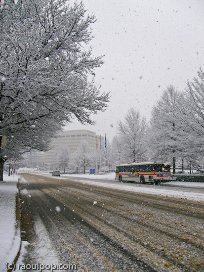
I suppose I should call this “Trip to the C&O Canal – Part Three”, since it’s the third time I write about the C&O Canal (Chesapeake and Ohio Canal) on my site. Here is Part 1 and Part 2. But it’s certainly not our third trip, because we’ve been there numerous times, during various times of the year.

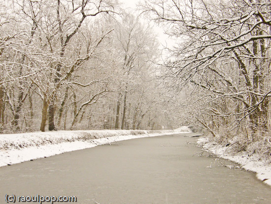
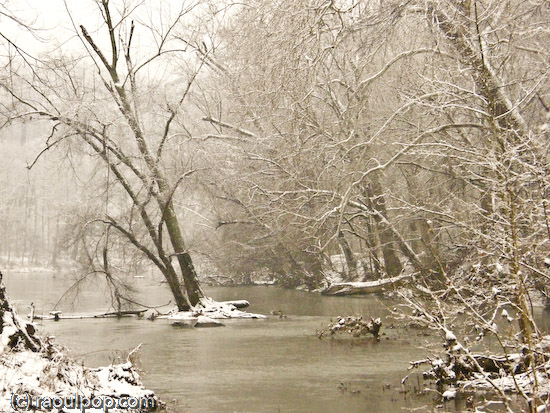
This last time, we did it by bike, starting at Lock 7, which can be accessed from the Southbound Clara Barton Parkway. We traveled past the last gatehouse, which I think was was Lock 12, and past the Carderock Wall, to some section of the canal beyond it.

It’s a lot of fun to bike on the C&O Canal. For one thing, the path that accompanies the canal used to be the old towpath for the mules that pulled the barges, so you know you’re stepping on a piece of history. For another, the canal towpath was built to have no steep grades. Other than little hills that correspond to the drops in altitude at lock gates, the towpath is mostly level, so you won’t get long-winded trying to walk, run or bike up long hills.

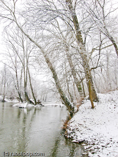
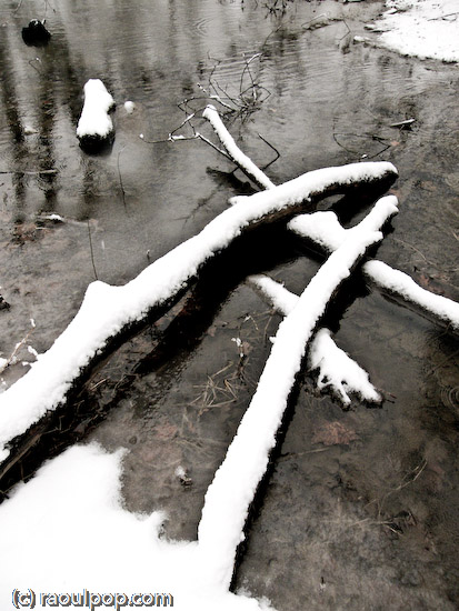
As you’ll see in the photos above, some parts of the canal were completely dry. I’m not sure what caused this. Perhaps it was the summer heat, or as you’ll see in a couple of the photos, a sinkhole that opened upstream and possibly swallowed all of the water from those sections of the canal.

The idea for the C&O Canal originated with George Washington, though in another form. Having worked as a land surveyor in his youth, he dreamed of the possibility of making the Potomac River navigable. He thought the only way to do it would be to build skirting canals around its falls. While he was still young, he could not convince the State of Maryland to do this, but after the Revolutionary War, let’s just say it was easier for him to get people to do things.

The Patowmack Company was formed in 1784, and construction began on the skirting canals. Washington himself supervised the construction personally. Beside the canals, channels in the river itself were deepened and boulders were removed. There was a great deal of work to be done, and the work wasn’t finished until 1802, three years after Washington’s death.

Although the canals were useful, the route didn’t generate as much traffic as it should have. For one thing, it was only truly usable up to two months out of the year, due to low water levels. Plus, it was very difficult to get the boats back up the river, because of the current. People ended up dissembling the boats downstream, walking back upstream, and building another boat. This was not efficient nor productive.

George Washington’s idea was interesting, and people kept thinking of a way to capitalize on it. A way to use the Potomac River needed to be found. That’s where the construction of a canal came in. It wasn’t new technology, as that sort of construction was already used in Europe, and even dates back to antiquity.

On November 5, 1823, a convention was held Washington, which led to the chartering of the company that would build the canal on January 27, 1824, and finally, to the start of construction of July 4, 1828.

The construction of the C&O Canal ended in October of 1850 at Cumberland, Maryland. The original plan to extend the canal to the Ohio River had to be modified, because of the extremely hard nature of the work, its slow progression, and financial troubles with the parent company.

Parts of the Canal were opened as they became available, and it worked as a water route until 1924. Frequent flooding closed it for months, and sometimes, for entire seasons, and in 1889, the parent company went bankrupt. It was then taken over by the canal’s rival, the B&O Railroad. In 1902, they even took over the boats. Whereas they had belonged to the people themselves — to the families that toiled night and day to carry goods down the canal — from that year forward, they belonged to the Railroad company…

The B&O Railroad did as little maintenance as possible on the canal, and in 1924, when another flood destroyed parts of it, they closed it down altogether. The canal slowly deteriorated afterwards, until it was taken over by the National Park Service in 1971. They restored the towpath and re-watered parts of the canal.

Here’s an interesting fact [source]:

“Transporting goods and people by canal dates back to antiquity. The lock gates used on the C&O Canal were an adaptation of a design by Leonardo DaVinci in the late 1400’s. Until the advent of the railroad, water travel was far superior to land travel.”

If you’d like more information about the C&O Canal, I recommend the official C&O Canal NPS website. Make sure to use the menu on the left side of the page to navigate through the various sections. It’s a little hard to find your way around at first, but it pays off if you keep digging — there’s a lot of information posted there.

Standard
Places

January snowfall

We had a snowstorm this past Thursday in the Washington, DC area. It started snowing around noon, and it continued to snow until about 4 pm. The snowflakes were big and fluffy, and they were coming down in thick waves. In the end, we have about 3 inches of accumulation, which started to melt overnight. By now, there are patches of snow here and there, but if this warmer weather continues, we’ll have nothing.

Here are photos taken during and after the snowstorm in various locations such as McLean (VA), Potomac River (MD side), and North Bethesda (MD).

Twigs weighed down by snow

Glass building in snowstorm

Road at Tyson’s Corner during snowstorm

Evergreen branch covered with snow

Here’s how my car looked during the snowstorm.

MINI covered in snow

MINI during snowfall

Visibility was (understandably) greatly reduced during the snowstorm. This tall crane normally dominates the skyline at Tyson’s Corner. Not during the snowstorm…

Tall crane during snowstorm

Always interested in shapes and abstracts, I couldn’t help photographing the tracks left in the snow by vehicles and people.

Bend it

Footsteps in the snow

Tracks in the snow

The fresh snow afforded me a different look at a spot I often visit: Lock 10 on the C&O Canal, which is located on the Clara Barton Parkway, somewhere between Great Falls and Glen Echo (MD).

C&O Canal at Lock 10 during snowstorm

Forest path at Lock 10

Potomac shoreline during snowstorm

Island

A bend in the river

Potomac River during snowstorm

A is for Abstract

Ice covers the buds

Finally, photos from my neighborhood. I’m glad I live in such a beautiful place.

Snowman rests on bench

Trees during snowfall

Branches covered in snow

During the snowstorm

Since this post includes photos from my community, let’s call it my Week 3 submission for the 2008 Community Challenge. My other submissions can be found under the “2008 community challenge” tag, right here on my site.

Standard
Places

Vantage point photography

It’s fun to change your photographic point of view every once in a while, especially if that opportunity is available to you. Fortunately, we live in an area with fairly tall buildings, so all we need to do is to get to the roof. The world sure is different from up there!

I took my own advice a couple of days ago, spurred on by the chance to try out a new camera: the SP-560UZ from Olympus, the most powerful ultra-zoom digital camera they make. It’s got a monster 18x zoom, the equivalent of 27-486mm focal range. I’m currently reviewing it, and should be able to publish my findings sometime in the 1st or 2nd week of February, perhaps sooner. So far, I like the camera a lot.

This is one photo that perhaps best exemplifies the camera’s powerful zoom. That Bethesda skyline is 5-7 miles away. With the naked eye, you can barely see those buildings, tiny as fleas, somewhere on the horizon. But the SP-560UZ bring them that close, and with its built-in image stabilization, lets me get a photo like this one while shooting handheld at maximum focal range.

Bethesda skyline

In another part of Bethesda, you can see this next building. I never noticed it was crooked before, but then again, I could never get this close to it before. I tried rotating the image to see if my horizon line was at fault — the cloud line was also crooked – but that wasn’t the case. When I line up the photo with the ground line horizontally, and with the trees vertically, the building clearly appears to be leaning to the right. I wonder if its owner knows of this.

Odd inclination

This is another photo I couldn’t get before: buildings near Montgomery Mall were always too far away for my reach.

Looking toward Montgomery Mall

Then I turned and looked toward Bethesda proper, which can always be recognized by the National Naval Medical Center tower. The National Institutes of Health are across the street from it, but they’re not tall enough to show above the tree line.

National Naval Medical Center at dusk

Here’s Wisconsin Avenue as it passes over I-495 and I-270.

Wisconsin Avenue at dusk

Here’s one of my favorite scenes. The photo shows NNMC, Wisconsin Avenue, the I-270 and I-495 overpasses, and the Metro Red Line, all at once. And to top it off, you can see the Metro itself rounding the corner as it climbs up from underground. That area is one of the most visually complicated transportation hubs I have ever seen. You’ve got two major interstate roads coming together in the valley below, Wisconsin Avenue bridging the gaps over the interstates (with the requisite exits onto each highway, of course), and above, the metro line, on an overpass bridge that comes up, out of the ground somewhere in the middle of the photo. And then you’ve got Tuckerman Lane and Grosvenor Lane, plus a bunch of other roads, spilling onto Wisconsin Avenue as well. It’s one big traffic spaghetti bowl, that’s what it is.

Looking toward Bethesda

While Ligia and I were up there, two news helicopters from Channel 4 and Channel 7 flew rapidly overhead, then hovered above over I-495 at some distance away. Looks like there was some sort of accident there, but we couldn’t see anything because of the tree cover.

Covering the news

The North Bethesda and Rockville skyline was something I’d always wanted to catch with a good tele lens as well. The SP-560UZ made it possible. These are the buildings near the White Flint metro station. I love the architecture of those buildings, and must make time to photograph them up close at some point.

Reflections at dusk

This is another view of North Bethesda that extends into Rockville. The tower in the lower left foreground belongs to Georgetown Preparatory School, which has been in existence at the same location since 1789.

North Bethesda skyline

This is another view of the North Bethesda skyline. That big building that fills the background is a huge condominium building, and the one with the golden windows is an office building. Every time I see those golden windows (and I’ve been seeing them for some time) I keep promising myself that I’ll get up close to photograph them, but it never happens. Perhaps I’ll manage to make time this year.

Rockville skyline

Finally, the road shown below is Tuckerman Lane, a major street that connects Rockville Pike to Old Georgetown Road and I-270 and I-495, at dusk.

Tuckerman Lane from above

You may or may not remember Tuckerman Lane from this photo I took last July.

Tuckerman Lane at sunset

This last photo was taken with the EF 100-400mm IS L series zoom from Canon, but to be fair, photos look a LOT better when it’s summer and you get that beautiful dusk light filling the scene than on a dreary, snow-less winter evening. Don’t judge the SP-560UZ harshly — its lens is very good given its price and intended market segment.

I keep talking about I-270 and I-495, and if you’re not from the area, you have no idea what they are. I-270 is a major local highway that cuts across Maryland from North to South and collects traffic going into and out of DC. I-495 is the beltway. You may have heard the expression “inside the beltway” with regards to Washington, DC. I-495 is that beltway, and it does just that — it surrounds DC and lets people travel around it as needed without having to deal with the major traffic delays associated with driving through DC. Of course, driving on the beltway itself it no picnic either. It’s one of the busiest highways in the US. At peak times, it’s bumper to bumper traffic, all the way…

By the way, this is my Week 2 post of the 2008 Community Challenge. Here’s Week 1.

Standard
Places

Sunset driving

The Maryland countryside is just beautiful, and we love to drive around whenever we can. Mostly, we go out in the evenings, looking for great spots where I can get photos of the sunsets. Here are a few I got recently in the rural areas around Poolesville:

Graze

Sun power

A good evening

As the light softly fades

Incidentally, we get around with our little sidekick, which we both love:

Sidekick

Standard
Places

White's Ferry and Edwards Ferry (part 2)

On 10/2, I wrote about our trip to these two sites along the C&O Canal here in Maryland. I couldn’t post the videos at that time. With the aid of YouTube, here they are, in chronological order, for your enjoyment.

I filmed this as the ferry pulled up to the Maryland side of the Potomac, and cars started to drive off:

This one shows the C&O Canal Trail near White’s Ferry. It’s a peaceful walk through the forest, with Ligia up ahead:

These next two show us driving through the Maryland countryside, on an unpaved road in a field somewhere between White’s Ferry and Edwards Ferry. I believe the road is River Road, although the map is unclear on this.

This is the launch point at Edwards Ferry, which has no ferry any more, but it’s a nice and peaceful place to visit. The fact that is has no ferry is actually a plus, since there are no crowds there. You can park your car and hike around, taking lots of photos. What’s also interesting about Edwards Ferry is that the C&O Canal’s water stops right there. The canal wasn’t maintained between it and White’s Ferry. So it’s kind of cool to see water on one side of the lock gate, and grass on the other. This isn’t depicted in the video.

Standard